Tropical Storm Bertha Continues Westward Along the Gulf Coast

Atlantic
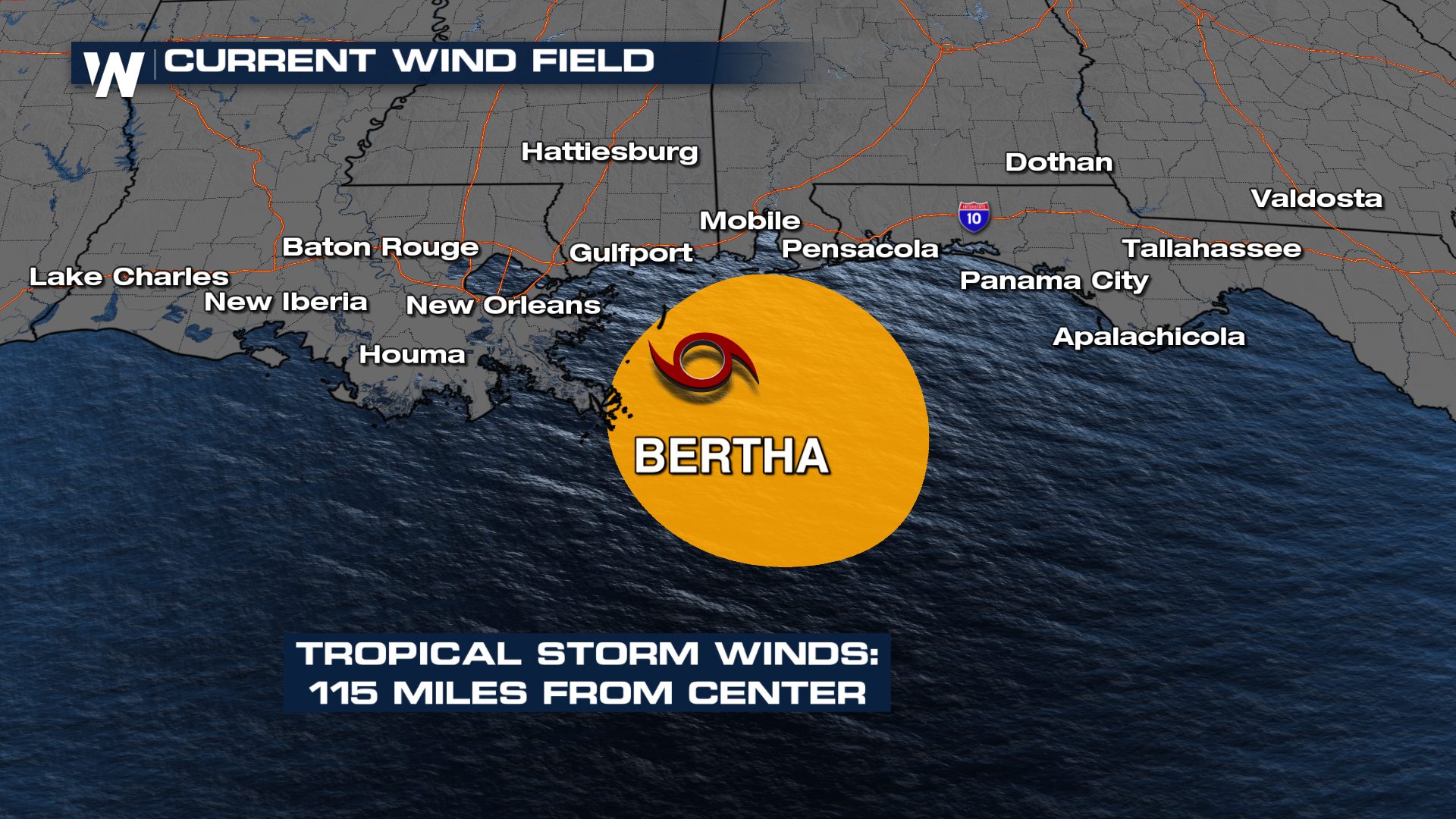
Tropical Storm Bertha is moving slowly westward along the northern Gulf Coast, bringing periods of heavy rain, gusty winds, rough surf, and coastal flooding to portions of the central Gulf Coast. While the storm is expected to remain a tropical storm for now, environmental conditions are becoming less favorable for additional strengthening. Betha is currently located 50 miles ENE of the mouth of the Mississippi River; the storm continues to bring impacts to the Gulf Coast of Louisiana, Florida, Mississippi, and Alabama.
As of the latest advisory from the National Hurricane Center (4 a.m. CDT), Bertha was tracking west at a slow pace, steered by a ridge of high pressure to its north. That general motion is expected to continue through the next couple of days, with the center remaining near the northern Gulf Coast before eventually moving inland. Once the system loses access to the warm Gulf waters that fuel tropical cyclones, gradual weakening is anticipated.
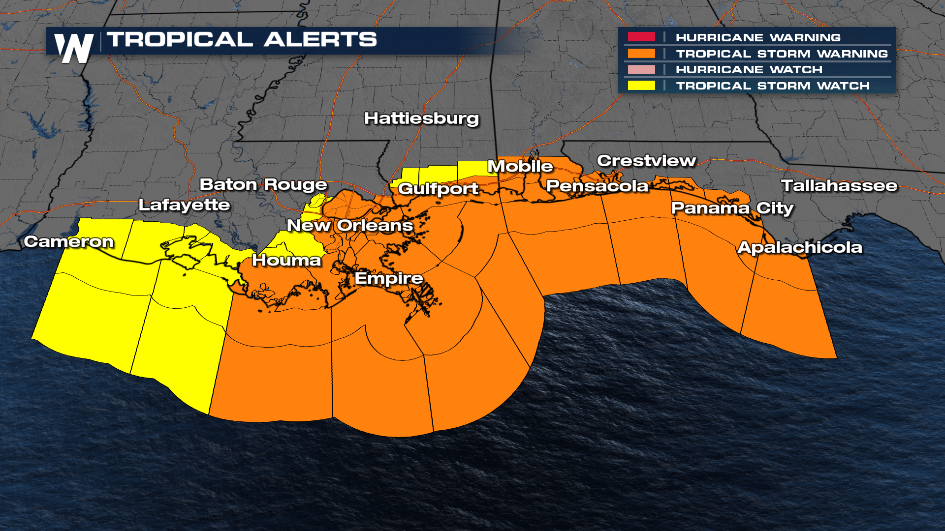
There are Tropical Storm Alerts in effect. Tropical Storm Warning remains in effect from the Florida Panhandle westward to Morgan City, Louisiana, including New Orleans and Lake Pontchartrain. A Tropical Storm Watch continues farther west into Southwest Louisiana.
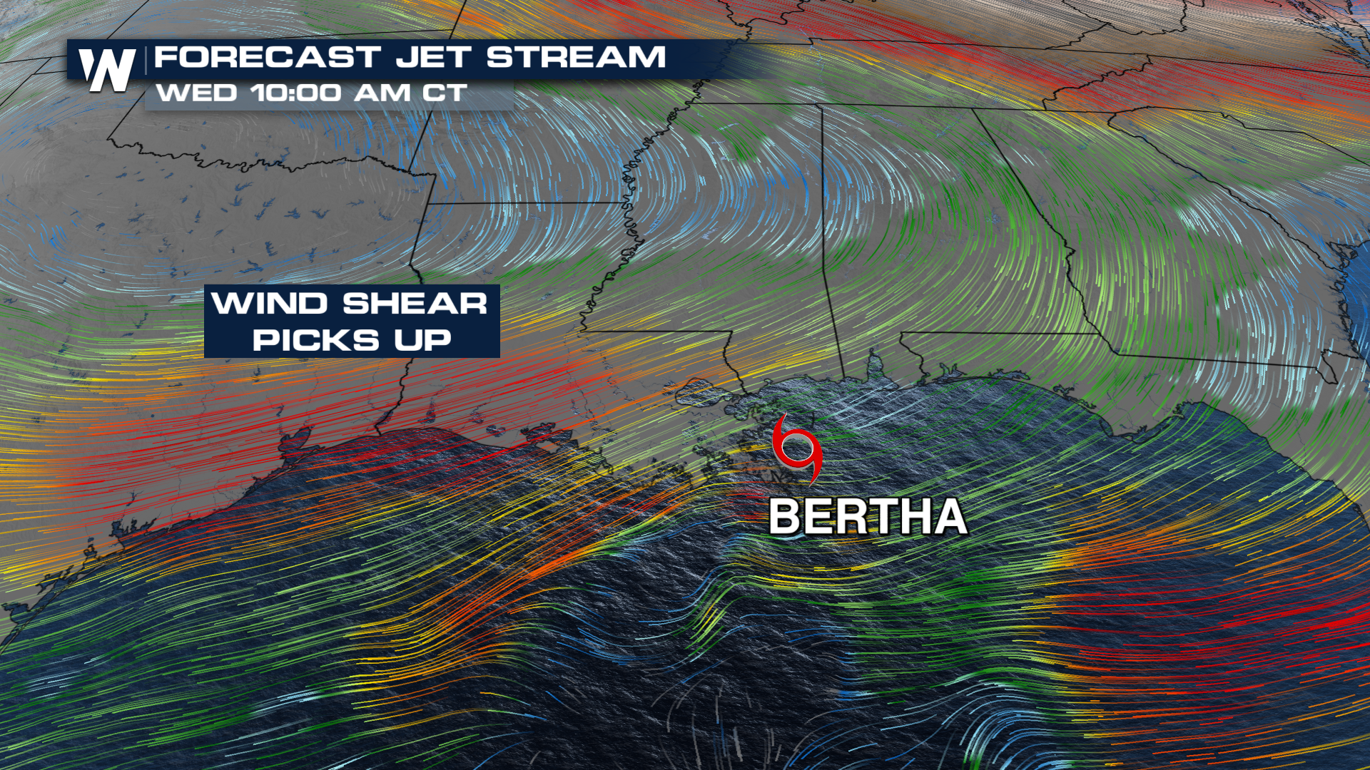
 Although water temperatures remain warm enough to support tropical development, the atmosphere surrounding Bertha is becoming increasingly hostile. Strong southwesterly wind shear is disrupting the storm’s vertical structure by pushing the deepest thunderstorms away from the center of circulation. Satellite imagery continues to show that the bulk of the strongest convection remains displaced east of the center, preventing Bertha from developing a more organized inner core.
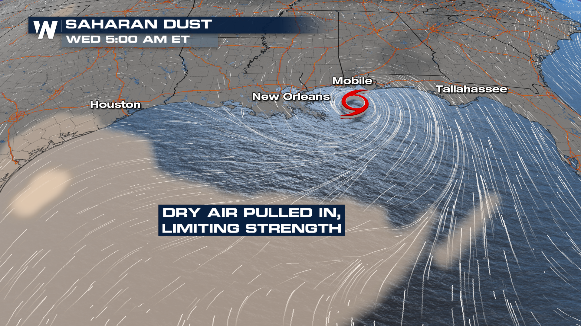
Dry air is also being drawn into portions of the circulation, further limiting thunderstorm development near the storm’s center. Together, the combination of persistent wind shear and dry air intrusion is expected to keep Bertha from intensifying significantly before it reaches the coast.
Even without strengthening, Bertha will continue to produce a wide range of hazards across the northern Gulf Coast. Bands of tropical downpours are expected to bring periods of heavy rainfall capable of producing localized flash flooding, especially in low-lying and urban areas where drainage is poor. The threat will be greatest where multiple rain bands move over the same locations.
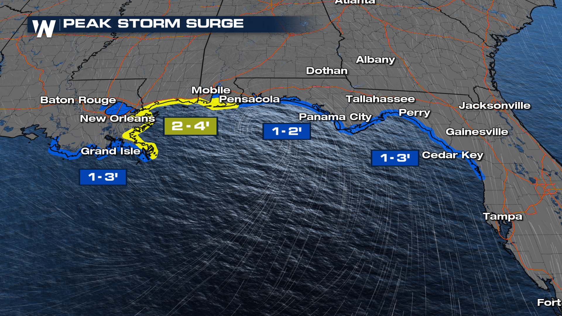
The biggest threat to watch for along the coast is storm surge. Peak storm surge could reach 2-4ft for portions of Louisiana and Mississippi.
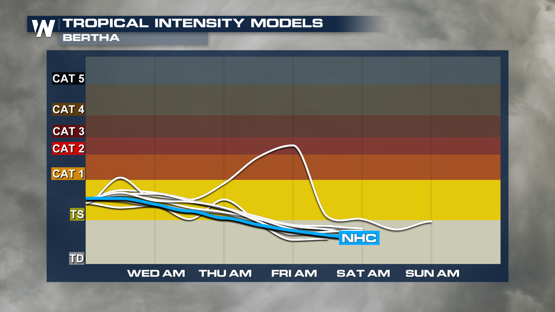
The expectation is that whatever develops will drift westward, potentially making landfall as far west as Texas or Louisiana. A lot will depend on where the circulation fully develops, so there is considerable uncertainty. Below is the intensity model forecast. The center blue line is what is anticipated by the National Hurricane Center. Most models indicate a strengthening to tropical storm strength but keep the storm below hurricane strength.
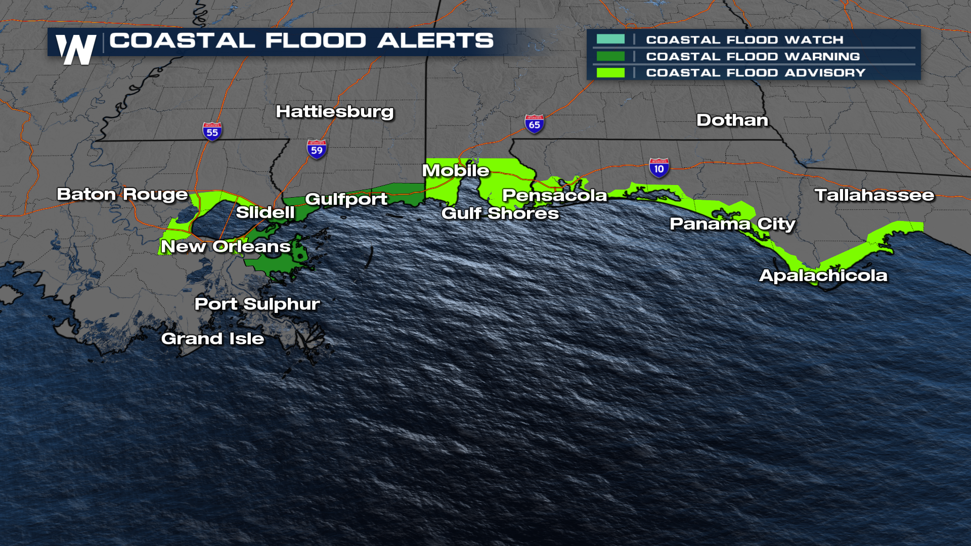
 Tropical-storm-force wind gusts will remain possible near and east of the center, where the strongest winds are concentrated. Those winds could down tree limbs, cause isolated power outages and create hazardous conditions for mariners. Persistent onshore flow will also elevate water levels along portions of the Louisiana, Mississippi, Alabama and Florida coastlines, leading to areas of coastal flooding and rough surf. Dangerous rip currents are also expected along Gulf Coast beaches.
Pacific
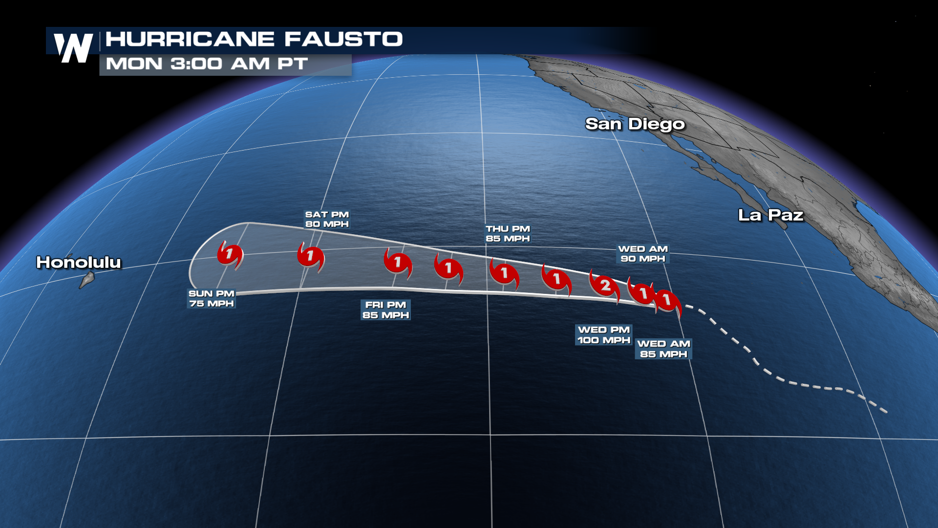
There are a few other areas we are monitoring in the Eastern Pacific. Hurricane Fausto has officially formed, along with another area behind Fausto that has a medium chance of tropical development in the next 7 days.
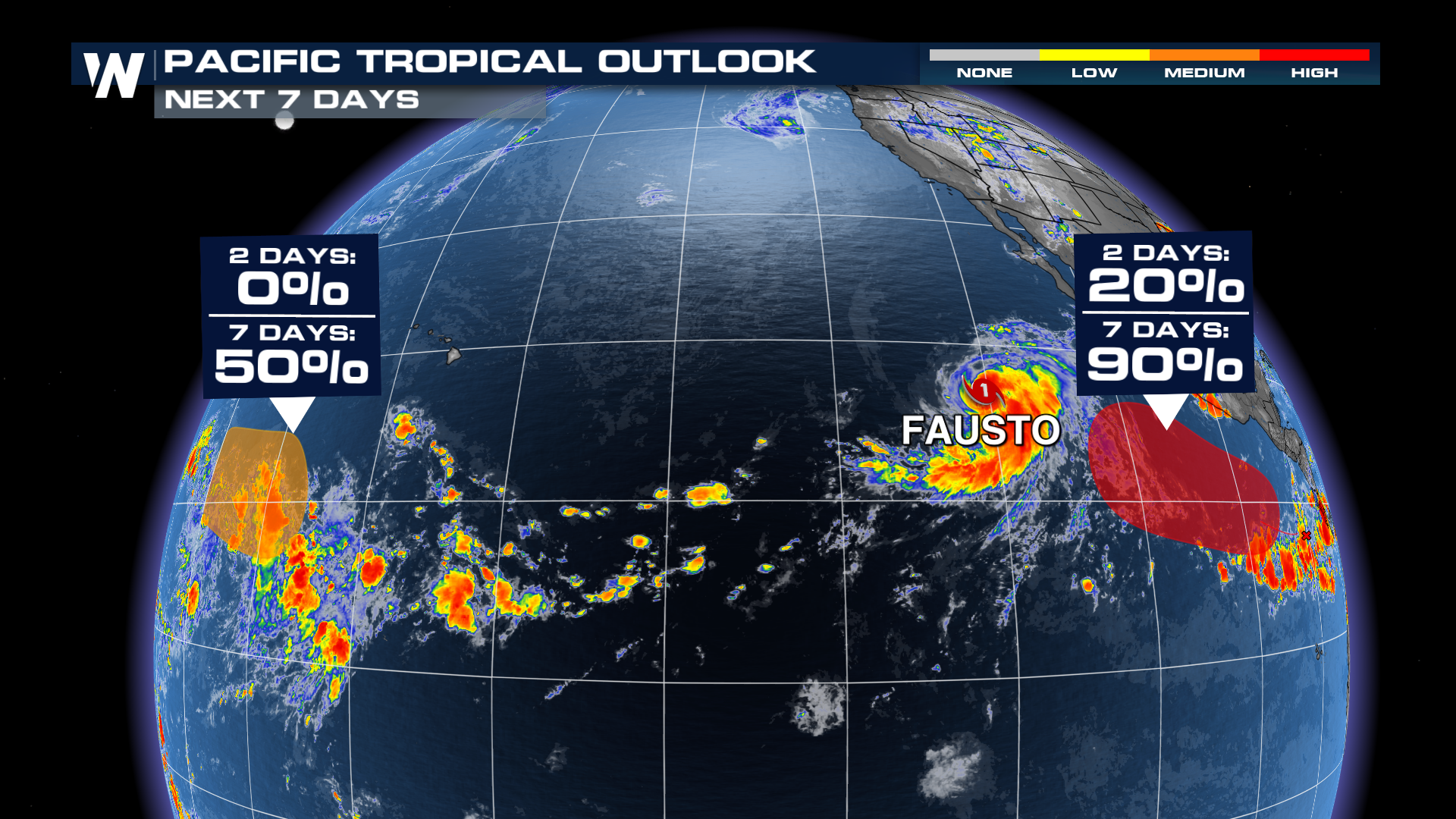
Now a hurricane, Fausto is expected to track westward and potentially intensifying into a Category 2. It's still way too soon to tell if it's going to have any effect on the Hawaiian islands.